
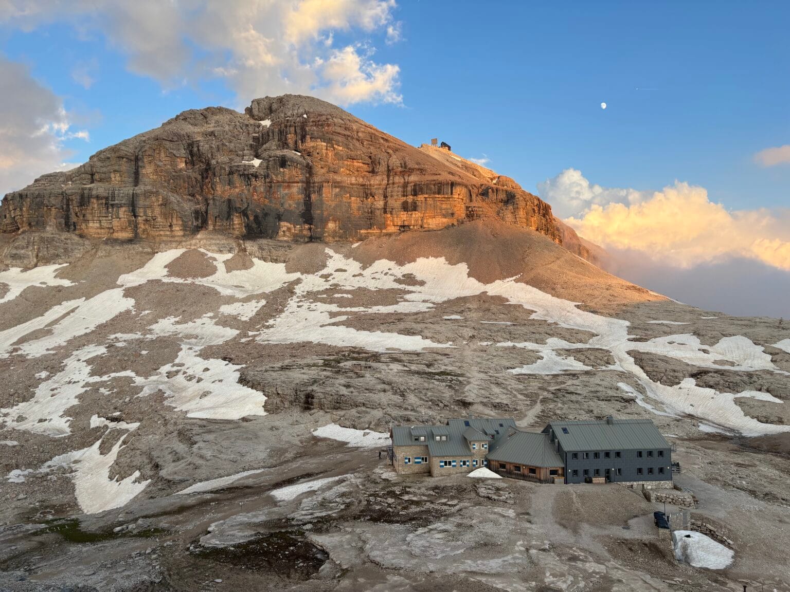

Located in the Sella mountain group, Piz Boè rises to 3,152 metres and is one of the most accessible 3,000-metre peaks in the Dolomites. There are several ways to reach it: you can take a cable car, follow a mountain trail or choose one of the many via ferrata routes leading to the summit.
Saying that the views from Piz Boè are spectacular almost feels like an understatement. Once you reach Rifugio Capanna Piz Fassa, located right at the summit, you are rewarded with a 360-degree panorama of the surrounding mountain groups, including Marmolada, Catinaccio and Sassolungo.
The Sella Group itself is also unique. Its pale, rugged, almost moon-like landscape creates views that you will not find anywhere else in the Dolomites.
Hiking route to Piz Boè without a via ferrata
🅿️ Trailhead and parking: Passo Pordoi
The easiest way to reach Piz Boè is to take the cable car from Passo Pordoi to Sass Pordoi. Information about summer cable car prices and operating times is available on the official Sass Pordoi website.
From Sass Pordoi, a wide and well-marked trail winds its way towards the pyramid-shaped summit of Piz Boè. Near the beginning of the final ascent, the trail becomes steeper. Fixed cables appear in a few places, but this is not an official via ferrata.
Using a via ferrata lanyard here is possible, although most hikers do not use one. The cables are mainly there to help with balance and support. During the main hiking season, this route can become very busy. Some hikers do not always follow the marked trail, so pay attention to the signs. The marked route is also the easiest way to reach the summit.
An interesting fact about Passo Pordoi
Passo Pordoi is extremely popular with cyclists, especially during the summer. You are likely to see plenty of them on the road. The pass is one of the seven Dolomite passes included in the Maratona dles Dolomites amateur cycling race.
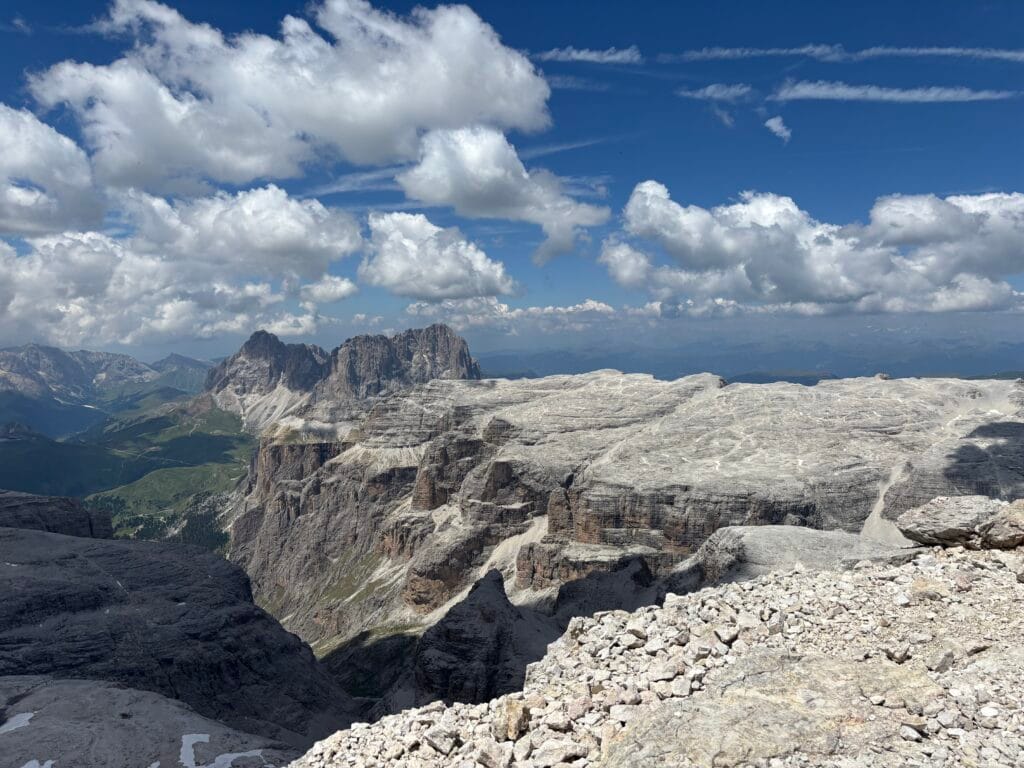
Piz Boè to Rifugio Boè
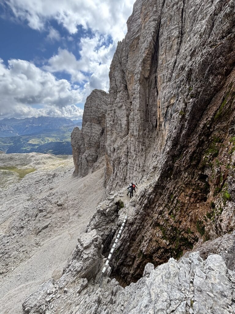
From the summit of Piz Boè, a gravel trail descends towards Rifugio Boè. About halfway along the route, the trail leads through a short section protected by fixed cables.
On maps, this section is marked as the Boè via ferrata. However, the cables are mainly there for support, and using via ferrata equipment is not usually necessary in this short section. Conditions can vary, though, so make your own decision based on the weather, trail conditions and your experience.
It is important to note that the cables split into two separate sections here. One is intended for people travelling downhill, while the other is for those travelling uphill. Follow the signs carefully and make sure you do not choose the wrong direction.
After descending the cable protected section, you may still encounter snow, especially at the beginning of the summer season. The snowfields are generally quite gentle. We crossed them comfortably at the end of June and did not need crampons.
Return route: Rifugio Boè to Sass Pordoi
You can return to Sass Pordoi by following the trail around Piz Boè. This means you do not need to climb back up to the summit.
The return journey takes approximately one hour.
Route map
Via ferrata Vallon, grade B/C
🅿️ Trailhead and parking: Alta Badia cable car, Corvara in Badia
For hikers with previous mountain and via ferrata experience, Via ferrata Vallon is one of the most beautiful routes to Piz Boè.
The easiest way to reach the start of the route is from Corvara in Badia. This is the main ski resort in the area, so several cable cars operate from the town. To reach Via ferrata Vallon, first take the Boè gondola and then the Vallon chairlift. The upper station is located next to Rifugio Kostner.
Via ferrata Vallon takes approximately one hour. The climbing is steep, engaging and very enjoyable. The route also includes a suspension bridge.
All the fixed cables and anchors had recently been renewed when we visited, which made the route feel even more secure. Surprisingly, Via ferrata Vallon is not particularly popular, despite being such a beautiful route. We met only two other people, so it felt as though we had the entire via ferrata to ourselves.
For more information, see the detailed guide to Via ferrata Vallon to the summit of Piz Boè.
Piz Boè to Rifugio Boè
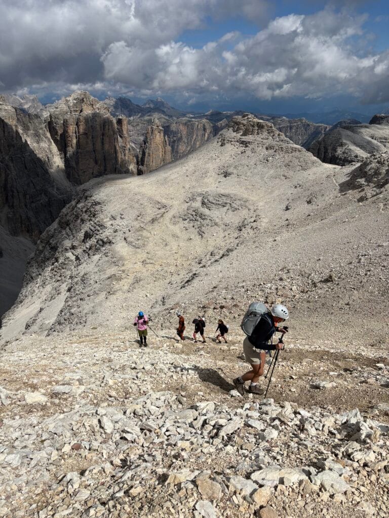
After completing the via ferrata, we followed the marked trail to the summit of Piz Boè. From the summit, the route continues towards Rifugio Boè, following the same trail described in the hiking route above.
Return route 1: Rifugio Boè to Piz Boè, Rifugio Kostner and Corvara
The quickest way to return to Corvara is to follow the trail towards Rifugio Kostner.
The trail starts at Piz Boè, so you first need to climb back up to the summit. From there, the route descends almost continuously. It is easy to follow and well marked, apart from one section crossing an unpleasant scree slope.
The scree section is equipped with fixed cables and additional ropes for support. Once you have crossed it, a wide and easy trail leads all the way to Rifugio Kostner, allowing you to enjoy the mountain views along the way.
From Rifugio Kostner, take the Vallon chairlift down and then continue by Boè gondola.
Route map
Return route 2: Rifugio Boè to Rifugio Pisciadù and Corvara
This option is longer, but it allows you to see more of the unique Sella mountain group.
The trail leads from Rifugio Boè past Rifugio Pisciadù and the nearby Lago Pisciadù. If you would like to make the day longer, you can also climb to the summit of Pisciadù, which reaches 2,985 metres.
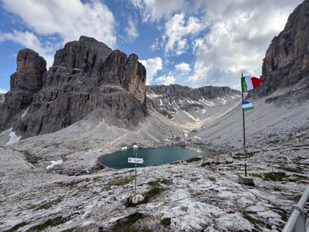
From Rifugio Pisciadù, you can descend all the way to the valley and the village of Calfosch. From there, it is easy to walk back to the Alta Badia cable car parking area.
Route map
Via ferrata Cesare Piazzetta, grade D
🅿️ Trailhead and parking: Sacrario Germanico del Passo Pordoi
For experienced via ferrata climbers or people with a background in rock climbing who want to test themselves, I highly recommend Via ferrata Cesare Piazzetta.
This is the most difficult route to Piz Boè and one of the hardest via ferratas in the Dolomites. The route begins with a steep vertical wall where there are very few places to put your feet. You need to pull yourself up using your arms and press your feet directly against the rock.
Once the route turns sideways and begins to traverse the wall, there are opportunities to hang from your via ferrata lanyard and rest. This was the only via ferrata I had climbed where I genuinely needed to use my lanyard to rest.
It was incredibly difficult, but also incredibly enjoyable.
The closest place to access Via ferrata Cesare Piazzetta is the car park near the Sacrario Germanico del Passo Pordoi memorial. Long-term parking is not officially permitted there, so we left the car a little further away beside the road. Parking was free when we visited.
From the memorial, it takes approximately 1.5 hours to reach the beginning of the via ferrata.
For more information, see the detailed guide to Via ferrata Cesare Piazzetta, the most challenging route to the summit of Piz Boè.


Piz Boè to Rifugio Boè
After completing the via ferrata, we followed the marked trail to the summit of Piz Boè. From there, the trail continues towards Rifugio Boè, as described in the hiking route above.
Return route: Rifugio Boè to Sass Pordoi and the parking area
The quickest way to return to the car is to take the cable car from Sass Pordoi down to Passo Pordoi. From there, follow the trail directly to the Sacrario Germanico del Passo Pordoi parking area.
If you prefer to avoid the cable car, you can descend directly to Passo Pordoi using the gravel trail that winds down beneath the cable car.
My quadriceps were burning after this descent. However, if your knees are holding up well, it is a perfectly possible option, and the views are beautiful all the way down.
Route map
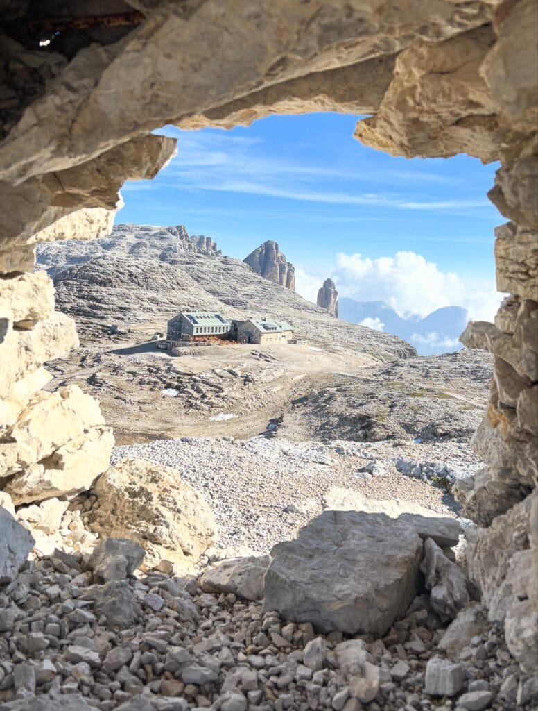
Staying overnight at Rifugio Boè
You can book an overnight stay at Rifugio Boè online through the hut’s official website.
The hut was recently renovated and expanded, so it can accommodate more guests. Because of this, I only made our reservation about a month before our planned trip in June. There were still beds available for our dates, but for the busiest period in July, I would recommend booking your stay well in advance.
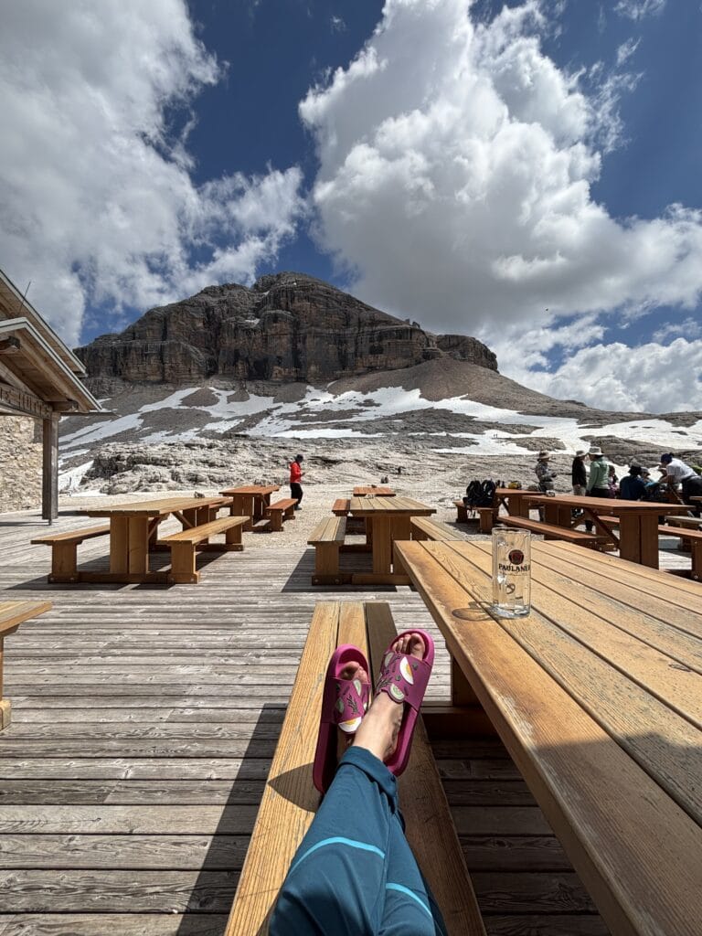
Staying at Rifugio Boè is also a good option if you want to enjoy the surrounding via ferratas without having to complete everything in one long day.
Via ferrata Koburger, grade A
If you are staying at Rifugio Boè and want to stretch your legs with a short route, Via ferrata Koburger is an excellent option close to the hut.
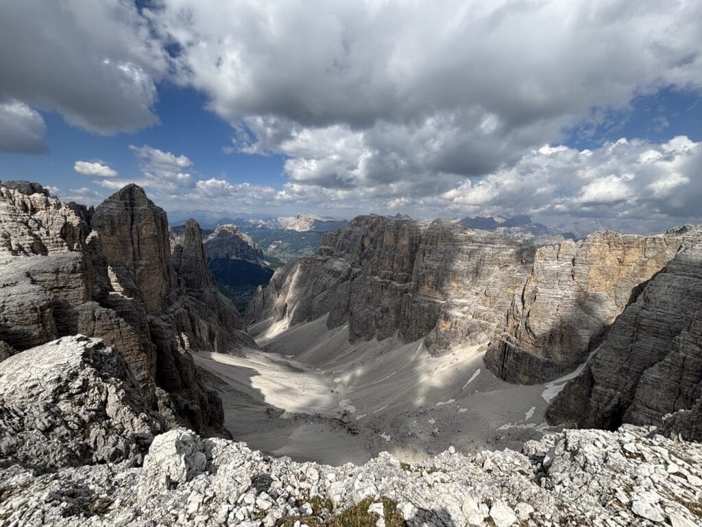
Rated A, it is suitable for anyone who would like to try their first via ferrata. The route traverses the area beside Mount l’Antersass. Although some sections feel exposed, there are comfortable footholds and the route is very well protected.
The views are beautiful.
To return to Rifugio Boè, follow the easy trail over the summit of l’Antersass.
Even though this via ferrata is easy, you still need appropriate via ferrata safety equipment. You can read more about equipment, clothing and route grades in the guide Via Ferrata: How to Prepare, What to Wear and How to Choose a Route.
The perfect sunset viewpoint
Whenever I stay in a mountain hut, I love watching the sunset. At Piz Boè, one of the best sunset viewpoints is the small hill directly behind Rifugio Boè.
It is marked as a summit on the map, although I was not able to find its name. At first glance, it does not look like a place people climb, but it is actually quite easy to reach.
From the top, you can see both Rifugio Boè and Piz Boè.
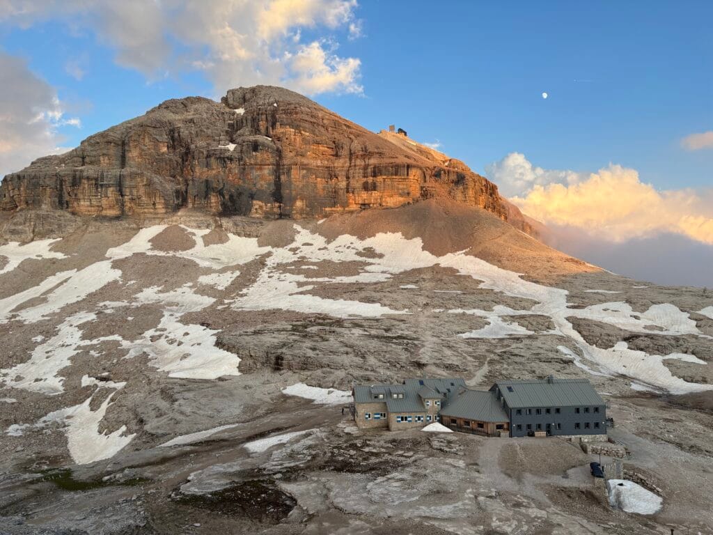
❗A sudden mountain storm
While we were enjoying the sunset, the sky suddenly became cloudy and something strange started happening to our hair. We looked at one another and realised that our hair was standing up and becoming static.
For a few moments, we stood there trying to understand what was happening. Then we remembered that static hair in the mountains can be a warning sign of an approaching thunderstorm.
If you notice this, leave exposed terrain immediately and move towards shelter. Do not wait to see what happens, especially if there is a risk of lightning. We hurried back towards the hut without saying a word. Luckily, it was very close.
A few minutes later, heavy rain and a thunderstorm arrived.
It was a good reminder that you should always stay alert in the mountains. Weather conditions can change within minutes, even when the day begins with clear skies.
Other useful information
- You can buy snacks and water at all the mountain huts along these routes.
- During the summer season, the last cable cars descending from the mountains usually run at around 4:30 pm. Always check the current timetable on the official websites and plan your route accordingly.
- Parking at Passo Pordoi and near the Alta Badia cable cars is paid. Card payments are accepted.
- It is possible to leave your car overnight in the parking areas, but always check the current parking rules before your trip.
- Route conditions, snow coverage and cable car timetables can change, so check the latest local information before setting out.
- Choose a route that matches your experience and use appropriate safety equipment for the conditions